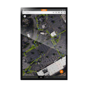
{"id":1515858165806,"title":"Effigis EZTag CE - GNSS\/GIS Data Collection Software","handle":"effigis-ez-tag-ce-software","description":"\u003cp\u003eEZTag CE allows you to easily collect geospatial data, including points, lines and polygons, along with their specific attributes. Ready-to-use without programming, the EZTag CE data dictionary editor manages simple and relational data models. Users can customize the data capture properties to match their own office database structure.\u003c\/p\u003e\n\u003cp\u003e\u003cbr\u003eOther benefits:\u003c\/p\u003e\n\u003cp\u003e\u003cbr\u003eThe EZTag CE Plan View swiftly and efficiently displays vector and raster map data, along with collected GNSS features.\u003cbr\u003eTo ensure the very best accuracy from the mobile GIS\/GNSS unit of your choice, EZTag CE allows you to collect valuable GNSS observations, necessary for post-processing.\u003c\/p\u003e\n\u003cp\u003e \u003c\/p\u003e\n\u003cul\u003e\u003c\/ul\u003e","published_at":"2018-11-07T04:11:29-05:00","created_at":"2018-11-06T08:32:24-05:00","vendor":"Effigis Geo Solutions","type":"GPS","tags":["Black Friday 2023","discounted","gps units","Non-Stock","tablet computers"],"price":96525,"price_min":96525,"price_max":96525,"available":true,"price_varies":false,"compare_at_price":null,"compare_at_price_min":0,"compare_at_price_max":0,"compare_at_price_varies":false,"variants":[{"id":13750891642926,"title":"Default Title","option1":"Default Title","option2":null,"option3":null,"sku":"JUN22510","requires_shipping":true,"taxable":true,"featured_image":null,"available":true,"name":"Effigis EZTag CE - GNSS\/GIS Data Collection Software","public_title":null,"options":["Default Title"],"price":96525,"weight":240,"compare_at_price":null,"inventory_quantity":0,"inventory_management":null,"inventory_policy":"continue","barcode":"","requires_selling_plan":false,"selling_plan_allocations":[],"quantity_rule":{"min":1,"max":null,"increment":1}}],"images":["\/\/theforestrystore.com\/cdn\/shop\/products\/JUN22510_963b8b75-3e58-49ea-b43b-7c54517e0733.jpg?v=1702446373"],"featured_image":"\/\/theforestrystore.com\/cdn\/shop\/products\/JUN22510_963b8b75-3e58-49ea-b43b-7c54517e0733.jpg?v=1702446373","options":["Title"],"media":[{"alt":"Effigis EZTag CE - GNSS\/GIS Data Collection Software","id":35749020762305,"position":1,"preview_image":{"aspect_ratio":1.093,"height":215,"width":235,"src":"\/\/theforestrystore.com\/cdn\/shop\/products\/JUN22510_963b8b75-3e58-49ea-b43b-7c54517e0733.jpg?v=1702446373"},"aspect_ratio":1.093,"height":215,"media_type":"image","src":"\/\/theforestrystore.com\/cdn\/shop\/products\/JUN22510_963b8b75-3e58-49ea-b43b-7c54517e0733.jpg?v=1702446373","width":235}],"requires_selling_plan":false,"selling_plan_groups":[],"content":"\u003cp\u003eEZTag CE allows you to easily collect geospatial data, including points, lines and polygons, along with their specific attributes. Ready-to-use without programming, the EZTag CE data dictionary editor manages simple and relational data models. Users can customize the data capture properties to match their own office database structure.\u003c\/p\u003e\n\u003cp\u003e\u003cbr\u003eOther benefits:\u003c\/p\u003e\n\u003cp\u003e\u003cbr\u003eThe EZTag CE Plan View swiftly and efficiently displays vector and raster map data, along with collected GNSS features.\u003cbr\u003eTo ensure the very best accuracy from the mobile GIS\/GNSS unit of your choice, EZTag CE allows you to collect valuable GNSS observations, necessary for post-processing.\u003c\/p\u003e\n\u003cp\u003e \u003c\/p\u003e\n\u003cul\u003e\u003c\/ul\u003e"}
Effigis EZTag CE - GNSS/GIS Data Collection Software


Related Products
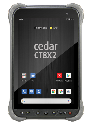
Cedar CT8X2 Android Tablet
$1,693.95

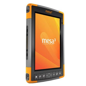
Juniper Mesa 3 Rugged Windows Tablet
From
$3,887.95
Mesa 3 Geo/Cell Rugged Android Tablet
$3,049.95

Effigis EZ-Surv Lite GNSS Software
From
$715.00
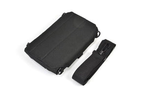
Juniper Mesa Tablet Case
$154.95